I’m very glad to announce release of Extended QGIS Web Client 1.4 with Editing plugin.
For full list of changes and code for EQWC go to Github, I Will outline most important parts here. Updated demo is also available, link on GIS Clients page.
Plugins
Plugins are our idea to have separate functionality, that can easily be included or excluded from project without modifying any line of code. With future release we plan Web Administration where it Will be possible to activate plugin per certain project. Now plugin is activated, if the code is in plugins folder.
First task was to create Google StreetView plugin from existing features. That way it is possible to remove loading of Google Maps API if it is not needed. Meaning also that client is lighter and faster, and you can work in offline mode.
And another reason was to create option for upcoming commercial plugins. So first such plugin also released is Editor for EQWC for editing spatial data in web client. More information with simple video presentation – Editor for EQWC.
Auto Cache Management
Now you do not need to manually clear cache, when you make changes in QGIS project (like adding layers, changing styles,…). Time of cache is compared to time of modification of QGIS project (at the time you logged in) and if cache time is older, it is automatically recreated. So if you are logged-in you need to only logout and login again.
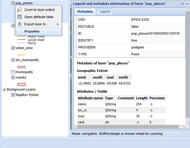
Context menu improvements
Now also for groups and displaying only relevant information. Also added layer properties part.
HTML in Identify Window
Very common demand is to display images inside of Identify Window (GetFeatureInfo) and not just hyperlinks. This is now possible and is very flexible, because you can add any HTML snippet with data from fields. One example is this:
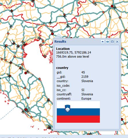
And how this is made here, read Part 3: https://github.com/uprel/gisapp/wiki/5.-Project-configuration#qgis-configuration
Improved Data Export
Use of extent is now optional, more vector types, more export formats.

